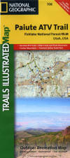
|
| |
 |
 |
|
 |
|
 |
 |
|
Paiute ATV Trail Map
&
Utah Topo
Software |
"Paiute ATV Trail System Map"

ALL NEWLY
REVISED FOR 2007
Contains NEW
Trails not shown on previous versions.
By National Geographic's Maps Trails Illustrated
- Topographical Map
- Water Proof
- Tear proof
- 100% Plastic Material
- GPS Waypoint Data for trails, points
of interest and intersections
- Detailed surrounding community access
information and routes.
|
|

Buy It NOW
|
|

"National Geographic's Topo!® CD-ROM set
for Utah" contains every topographic
map you could possibly need for the state.
The set includes 6 CD-ROMs with more than
1,550 scanned USGS maps enhanced with digital
3-D shading. You'll be able to interact
with the
maps
in more ways than you would think possible.
This set will enthrall the tech-savvy
outdoor explorer. You won't find mapping
software with more detail or customization
options. It's an excellent planning tool
for backcountry adventures or road trips.
- Draw freehand routes
and upload to a GPS
- Reference thousands
of preloaded GPS waypoints
- Create custom text,
symbols, and map overlays
- 1:24,000 scale maps
with seamless statewide coverage
- Navigate and scroll
through the entire map area without
borders
- Photo quality resolution
for printing
- Works with all color
and black & white printers supported
by Windows
- Supports most popular
handheld GPS receivers manufactured
by Garmin, Eagle, Lowrance, and Magellan
- System Requirements:
Microsoft Windows 95, 98, ME, 2000,
NT; 16 MB of memory; double speed CD-ROM
drive; 256-color monitor; 486 DX/66MHz
PC or higher.
- Direct link requires
input/output capabilities and a PC cable
(sold separately)
- Upgrade to additional
functionality, including Palm and Pocket
PC compatibility, with Topo! Sync USA.
- Print your maps on
Adventure Paper, our durable, tear-resistant,
waterproof paper for inkjet printers.

Buy It NOW
|
Now
available
We have created the Utah Paiute ATV Trail
Topo® & GPS ADD-ON CD-ROM
With over 15000 Utah GPS waypoints marked
and ready to import into either the National
Geographic's Topo!® software
or into your GPS. We have annotated
maps with all the sights you won't want
to miss on the Paiute ATV Trail. We
did all the hard work for you. All you need
to do is import this into your copy of the
TOPO® software or download the
waypoints to your GPS and your off!
You can print the maps we included or use
the waypoint files directly in your favorite
GPS. We have provided files in several
easy to use formats to fit most GPS devices
on the market.
Note: This Add-CD can no longer be used
as a stand alone product without the National
Geographic's Topo!® software.
|
|
|
Sold to
you by:
Bushman
Web Services
256 S. Sly Fox Way
Sedalia Co 80135
Phone: (303) 660-9789
WE CAN ONLY ACCEPT CREDIT
CARDS VIA PAYPAL.
NO ORDERS WILL BE TAKEN BY PHONE.
SORRY NO EXCEPTIONS.
|
-->
|

|
|
|
|
|
 |
 |
©
1996-2008 by
Bushman Web Services.
Please read our
Copyright.
All Rights Reserved |
 |
 |
|
 |
|